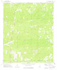
1971 Map of Rockford SW
USGS Topo · Published 1978About this map
The rural landscape of Coosa County unfolds along the winding waters of Hachemedega Creek and Weoka Creek in this early 1970s survey. Settlement patterns are primarily clustered around historic country churches and small rural hubs like Pentonville and Cottage Grove. The terrain is characterized by a complex network of branches and creeks, such as Little Sam Jack Creek and Lybrand Creek, which feed into the larger swamp systems including the curiously named Rapids Swamp.
Find a feature on this map
28 named features on this map. Tap any name to fly to it.
Don’t see what you’re looking for? This feature index may not catch every label — zoom into the map to look around manually.
Map Details
Editions of this 1971 Rockford SW Map
2 editions found
Other maps of this area

1901 · Wetumpka
USGS Topo · 1:125,000

1901 · Wetumpka
USGS Topo · 1:62,500

1903 · Wetumpka
USGS Topo · 1:125,000

1953 · Montgomery
USGS Topo · 1:250,000

1956 · Montgomery
USGS Topo · 1:250,000

1957 · Montgomery
USGS Topo · 1:250,000
1959 · Wetumpka
USGS Topo · 1:62,500

1959 · Elmore
USGS Topo · 1:62,500

1971 · Richville
USGS Topo · 1:24,000
1971 · Flag Mountain
USGS Topo · 1:24,000