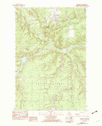
1982 Map of Rockland
USGS Topo · Published 1983About this map
Rockland serves as the primary settlement in this northern Michigan landscape, situated just north of the Ottawa National Forest boundary. The area's industrial legacy is evidenced by mining-related landmarks like C Shaft Hill and various gravel and sand pits, while the Escanaba and Lake Superior railroad line cuts through the northern terrain. The topography is defined by the winding Ontonagon River and its complex network of tributaries, including Sucker Creek, Rockland Creek, and the Baltimore River. To the west, the Victoria Reservoir and the settlement of Victoria illustrate the region's managed water resources. Notable natural features such as O Kun de Kun Falls and elevations like Military Hill and South Bluff highlight the varied relief of Ontonagon County. For genealogists, the Woodland Cem near Rockland provides a specific point of interest for local family history research.
Find a feature on this map
34 named features on this map. Tap any name to fly to it.
Don’t see what you’re looking for? This feature index may not catch every label — zoom into the map to look around manually.
Map Details
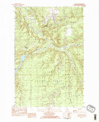
Editions of this 1982 Rockland Map
2 editions found
Other maps of this area

1949 · Rockland
USGS Topo · 1:62,500

1950 · Greenland
USGS Topo · 1:62,500

1951 · Rockland
USGS Topo · 1:62,500

1951 · Greenland
USGS Topo · 1:62,500

1955 · Ontonagon
USGS Topo · 1:62,500

1956 · Matchwood
USGS Topo · 1:62,500

1958 · Iron River
USGS Topo · 1:250,000

1960 · Iron River
USGS Topo · 1:250,000

1961 · Iron River
USGS Topo · 1:250,000

1967 · Iron River
USGS Topo · 1:250,000