Loading...
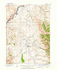
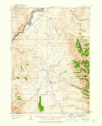
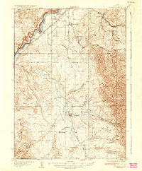
Loading map...1934 Map of Rockland
USGS Topo · Published 1963About this map
The Snake River carves the northern boundary of this 1930s landscape, where the legacy of westward expansion is etched into the terrain. Traces of the Oregon Trail and the Old Oregon Trail run parallel to the river, passing through Neeley and near the prominent Massacre Rocks. The interior is defined by a series of rural schoolhouses, including Cold Creek Sch, Garris Sch, and Excelsior Sch, which served the scattered agricultural families of the Rockland Valley before mid-century consolidation.
Find a feature on this map
41 named features on this map. Tap any name to fly to it.
Don’t see what you’re looking for? This feature index may not catch every label — zoom into the map to look around manually.
Map Details
Date Portrayed1934
Date Published1963
PublisherU.S. Geological Survey
Map TypeTopographic
Scale1:62,500
Physical Dimensions17 x 20.9 inches
Editions of this 1934 Rockland Map
2 editions found
Historical Maps of Rockland Through Time
Featured Locations
Source Details
SourceU.S. Geological Survey
CopyrightPublic Domain