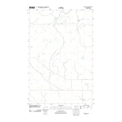
2011 Map of Rocklyn
USGS Topo · Published 2011About this map
Rocklyn and the surrounding agricultural landscape of Lincoln County define this portion of the Washington interior. The settlement sits at the southern edge of the quadrangle, connected to the wider region by a network of rural routes including Rocklyn Rd and Fictenberg Rd E. The drainage of Hawk Creek dominates the central topography, winding northward through the plateau toward Stock Canyon. Scattered water features such as Rock Lake, Hurley Lake, and Mosquito Spring highlight the unique hydrology of this basalt-carved terrain. The road network, featuring names like Sterett Rd and Sam Knack Rd N, reflects the deep-rooted family farm holdings and homesteading history of the area. This 2011 survey captures the enduring rural character of the region, where the intersection of water sources and high-plateau agriculture remains the primary driver of the landscape's organization.
Find a feature on this map
21 named features on this map. Tap any name to fly to it.
Don’t see what you’re looking for? This feature index may not catch every label — zoom into the map to look around manually.
Map Details
Editions of this 2011 Rocklyn Map
This is the sole edition of this map. No revisions or reprints were ever made.
Other maps of this area

1948 · Lincoln
USGS Topo · 1:62,500

1948 · Turtle Lake
USGS Topo · 1:62,500

1950 · Lincoln
USGS Topo · 1:62,500

1950 · Turtle Lake
USGS Topo · 1:62,500

1953 · Ritzville
USGS Topo · 1:250,000

1959 · Ritzville
USGS Topo · 1:250,000

1965 · Ritzville
USGS Topo · 1:250,000

1969 · Rocklyn SW
USGS Topo · 1:24,000

1969 · Bluestem
USGS Topo · 1:24,000

1969 · Telford
USGS Topo · 1:24,000