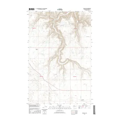
2017 Map of Rocklyn
USGS Topo · Published 2017About this map
Bachelor Prairie defines the western reaches of this Lincoln County landscape, showing a region of high plateau topography cut by significant drainage systems. The most prominent of these is Hawk Cr, which carves a deep path through the center of the sheet, joined by Stock Cr and winding through Stock Canyon. These watercourses create the primary relief in an otherwise agricultural and ranching environment, where isolated water sources like Mosquito Spring and small basins such as Hurley Lake and Rock Lake appear.
Find a feature on this map
26 named features on this map. Tap any name to fly to it.
Don’t see what you’re looking for? This feature index may not catch every label — zoom into the map to look around manually.
Map Details
Editions of this 2017 Rocklyn Map
This is the sole edition of this map. No revisions or reprints were ever made.
Other maps of this area

1948 · Lincoln
USGS Topo · 1:62,500

1948 · Turtle Lake
USGS Topo · 1:62,500

1950 · Lincoln
USGS Topo · 1:62,500

1950 · Turtle Lake
USGS Topo · 1:62,500

1953 · Ritzville
USGS Topo · 1:250,000

1959 · Ritzville
USGS Topo · 1:250,000

1965 · Ritzville
USGS Topo · 1:250,000

1969 · Rocklyn SW
USGS Topo · 1:24,000

1969 · Bluestem
USGS Topo · 1:24,000

1969 · Telford
USGS Topo · 1:24,000