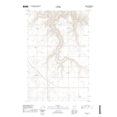
2020 Map of Rocklyn
USGS Topo · Published 2020About this map
Rocklyn sits at the edge of this Lincoln County landscape, where the basalt-heavy terrain of eastern Washington transitions through varied prairies and coulees. The drainage of Hawk Cr carves through the northern hills, creating the steep relief of Stock Canyon before winding southward toward the open reaches of Bachelor Prairie. This 2020 survey reveals a rural network defined by its hydrology, where small water bodies like Hurley Lake and Rock Lake persist alongside isolated features such as Mosquito Spring. The road system, including named routes like Sterrett Rd and Fictenberg Rd, follows the natural contours and section lines, serving the scattered agricultural tracts and ranching land that characterize the region. For those tracing the evolution of eastern Washington settlements, the map provides precise locations for the remaining structures and landmarks of the Rocklyn area.
Find a feature on this map
26 named features on this map. Tap any name to fly to it.
Don’t see what you’re looking for? This feature index may not catch every label — zoom into the map to look around manually.
Map Details
Editions of this 2020 Rocklyn Map
This is the sole edition of this map. No revisions or reprints were ever made.
Other maps of this area

1948 · Lincoln
USGS Topo · 1:62,500

1948 · Turtle Lake
USGS Topo · 1:62,500

1950 · Lincoln
USGS Topo · 1:62,500

1950 · Turtle Lake
USGS Topo · 1:62,500

1953 · Ritzville
USGS Topo · 1:250,000

1959 · Ritzville
USGS Topo · 1:250,000

1965 · Ritzville
USGS Topo · 1:250,000

1969 · Rocklyn SW
USGS Topo · 1:24,000

1969 · Bluestem
USGS Topo · 1:24,000

1969 · Telford
USGS Topo · 1:24,000