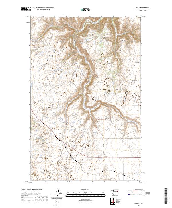
2023 Map of Rocklyn
USGS Topo · Published 2023About this map
Rocklyn sits at the southern edge of this Lincoln County landscape, serving as a focal point for a network of rural roads that crisscross the undulating terrain. The geography is defined by open stretches like Bachelor Prairie and the deep incision of Stock Canyon to the northeast. Water sources are vital markers in this semi-arid environment, including the course of Hawk Creek and the localized Mosquito Spring. The road network, including Sterrett Rd and Fictenberg Rd, follows the natural contours and section lines of the Public Land Survey System, reflecting a long-standing pattern of agricultural land division in eastern Washington. This 2023 survey documents the enduring spatial layout of family ranching and farming operations, where named routes like Hawk Creek Ranch Rd N and Crystal Springs Rd E provide access to the high plateaus and coulees.
Find a feature on this map
22 named features on this map. Tap any name to fly to it.
Don’t see what you’re looking for? This feature index may not catch every label — zoom into the map to look around manually.
Map Details
Editions of this 2023 Rocklyn Map
This is the sole edition of this map. No revisions or reprints were ever made.
Other maps of this area

1948 · Lincoln
USGS Topo · 1:62,500

1948 · Turtle Lake
USGS Topo · 1:62,500

1950 · Lincoln
USGS Topo · 1:62,500

1950 · Turtle Lake
USGS Topo · 1:62,500

1953 · Ritzville
USGS Topo · 1:250,000

1959 · Ritzville
USGS Topo · 1:250,000

1965 · Ritzville
USGS Topo · 1:250,000

1969 · Rocklyn SW
USGS Topo · 1:24,000

1969 · Bluestem
USGS Topo · 1:24,000

1969 · Telford
USGS Topo · 1:24,000