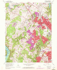
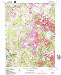
1965 Map of Rockville
USGS Topo · Published 1972About this map
The Rockville municipal center and its surrounding suburbs dominate this mid-century landscape, characterized by the rapid expansion of residential developments like Woodley Gardens and Hungerford Towne. The Baltimore and Ohio railroad corridor provides a central axis for growth, supporting a mix of civic infrastructure such as the Montgomery County Courthouse and educational institutions like Montgomery College. To the west, the terrain transitions into the more open spaces of Potomac, where family-named landmarks like Hunting Hill and institutional sites such as the U S Bureau of Standards sit among the headwaters of Muddy Branch. Along the southern edge, the Potomac River and the historic Chesapeake and Ohio Canal mark the transition toward Virginia, while interior areas show the emergence of specialized sites like the Derwood Experimental Laboratory and the Shady Grove Music Fair Theater.
Find a feature on this map
144 named features on this map. Tap any name to fly to it.
Don’t see what you’re looking for? This feature index may not catch every label — zoom into the map to look around manually.
Map Details
Editions of this 1965 Rockville Map
5 editions found
Other maps of this area

1890 · Mt. Vernon
USGS Topo · 1:125,000

1891 · Mt. Vernon
USGS Topo · 1:125,000

1893 · Frederick
USGS Topo · 1:125,000

1894 · Frederick
USGS Topo · 1:125,000

1894 · Mt. Vernon
USGS Topo · 1:125,000

1897 · Mt. Vernon
USGS Topo · 1:125,000

1900 · Washington
USGS Topo · 1:62,500

1908 · Rockville
USGS Topo · 1:62,500

1908 · Seneca
USGS Topo · 1:62,500

1915 · Fairfax
USGS Topo · 1:62,500