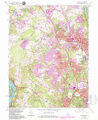
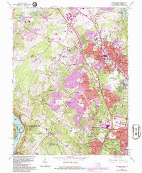
1965 Map of Rockville
USGS Topo · Published 1984About this map
Gaithersburg and Rockville anchor this 1960s-era snapshot of Montgomery County, a period defined by rapid suburban expansion. The sprawling campus of the U S Bureau of Standards dominates the northern landscape, while the Baltimore and Ohio Railroad and the Rockville Pike corridor facilitate the dense residential growth seen in neighborhoods like Twinbrook and Westmore. To the west, the terrain transitions into more wooded and equestrian-focused estates near Hunting Hill and Potomac, where the Potomac River forms the southern boundary.
Find a feature on this map
140 named features on this map. Tap any name to fly to it.
Don’t see what you’re looking for? This feature index may not catch every label — zoom into the map to look around manually.
Map Details
Editions of this 1965 Rockville Map
5 editions found
Other maps of this area

1890 · Mt. Vernon
USGS Topo · 1:125,000

1891 · Mt. Vernon
USGS Topo · 1:125,000

1893 · Frederick
USGS Topo · 1:125,000

1894 · Frederick
USGS Topo · 1:125,000

1894 · Mt. Vernon
USGS Topo · 1:125,000

1897 · Mt. Vernon
USGS Topo · 1:125,000

1900 · Washington
USGS Topo · 1:62,500

1908 · Rockville
USGS Topo · 1:62,500

1908 · Seneca
USGS Topo · 1:62,500

1915 · Fairfax
USGS Topo · 1:62,500