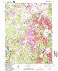
1965 Map of Rockville
USGS Topo · Published 1986About this map
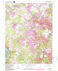
The Potomac River corridor and its surrounding suburbs undergo significant transformation on this survey, where the Chesapeake and Ohio Canal National Historical Park preserves a historical waterway while the nearby landscape transitions toward modern residential clusters. The core of Rockville is densely detailed, featuring civic landmarks like St Marys Ch and Montgomery College, alongside institutional sites including the U S Bureau of Standards.
Find a feature on this map
170 named features on this map. Tap any name to fly to it.
Don’t see what you’re looking for? This feature index may not catch every label — zoom into the map to look around manually.
Map Details
Editions of this 1965 Rockville Map
5 editions found
Other maps of this area

1890 · Mt. Vernon
USGS Topo · 1:125,000

1891 · Mt. Vernon
USGS Topo · 1:125,000

1893 · Frederick
USGS Topo · 1:125,000

1894 · Frederick
USGS Topo · 1:125,000

1894 · Mt. Vernon
USGS Topo · 1:125,000

1897 · Mt. Vernon
USGS Topo · 1:125,000

1900 · Washington
USGS Topo · 1:62,500

1908 · Rockville
USGS Topo · 1:62,500

1908 · Seneca
USGS Topo · 1:62,500

1915 · Fairfax
USGS Topo · 1:62,500