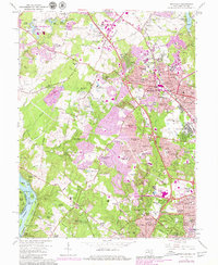
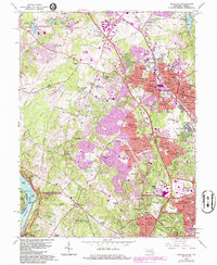
1965 Map of Rockville
USGS Topo · Published 1979About this map
The suburban landscape of central Montgomery County is captured here during a period of rapid mid-century expansion. At the heart of the sheet, Rockville serves as a bustling hub, showing a dense network of residential developments like Luxmanor and Tilden Woods pushing outward from the historic core. The industrial and transport backbone of the region is anchored by the Baltimore and Ohio railroad and major corridors like Viers Mill Rd and Rockville Pike.
Find a feature on this map
172 named features on this map. Tap any name to fly to it.
Don’t see what you’re looking for? This feature index may not catch every label — zoom into the map to look around manually.
Map Details
Editions of this 1965 Rockville Map
5 editions found
Other maps of this area

1890 · Mt. Vernon
USGS Topo · 1:125,000

1891 · Mt. Vernon
USGS Topo · 1:125,000

1893 · Frederick
USGS Topo · 1:125,000

1894 · Frederick
USGS Topo · 1:125,000

1894 · Mt. Vernon
USGS Topo · 1:125,000

1897 · Mt. Vernon
USGS Topo · 1:125,000

1900 · Washington
USGS Topo · 1:62,500

1908 · Rockville
USGS Topo · 1:62,500

1908 · Seneca
USGS Topo · 1:62,500

1915 · Fairfax
USGS Topo · 1:62,500