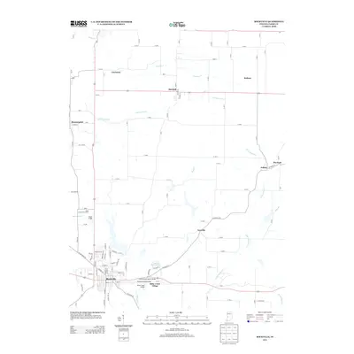
2013 Map of Rockville
USGS Topo · Published 2013About this map
Rockville serves as the central hub of this Indiana landscape, where the confluence of regional history and geography is on full display. The area is notable for its concentration of historic structures, particularly near Billie Creek Village, which preserves the architectural heritage of the county. Local connectivity is defined by numerous stream crossings, including the Beeson Covered Bridge, Leatherwood Station Bridge, and Billie Creek Bridge, highlighting the importance of the local waterway network. Small outlying settlements like Nyesville, Marshall, and Cincinnati dot the agricultural plains, connected by a grid of rural roads and the drainage systems of Little Raccoon Cr and Leatherwood Cr. To the north, the Parke County Golf Course and Catlin Bridge mark the transition toward more open terrain, while Bloomingdale sits on the western edge, providing a comprehensive look at the modern layout of these established Parke County communities.
Find a feature on this map
40 named features on this map. Tap any name to fly to it.
Don’t see what you’re looking for? This feature index may not catch every label — zoom into the map to look around manually.
Map Details
Editions of this 2013 Rockville Map
This is the sole edition of this map. No revisions or reprints were ever made.
Other maps of this area

1948 · Wallace
USGS Topo · 1:24,000

1949 · Alamo
USGS Topo · 1:24,000

1951 · Mecca
USGS Topo · 1:24,000

1951 · Mansfield
USGS Topo · 1:24,000

1952 · Catlin
USGS Topo · 1:24,000

1953 · Indianapolis
USGS Topo · 1:250,000

1955 · Rockville
USGS Topo · 1:24,000

1955 · Kingman
USGS Topo · 1:24,000

1955 · Montezuma
USGS Topo · 1:24,000

1956 · Indianapolis
USGS Topo · 1:250,000