Loading...
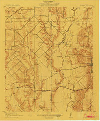
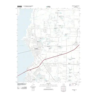
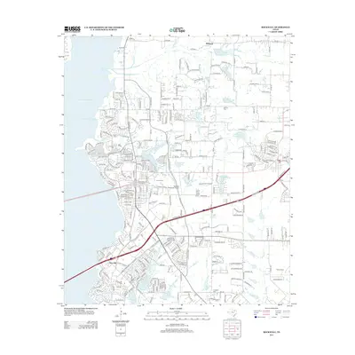
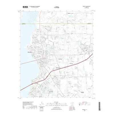
Loading map...1912 Map of Rockwall
USGS Topo · Published 1912About this map
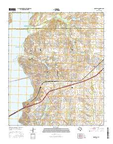
The Bois D'Arc River snakes through the heart of this North Texas survey, defining a landscape of intricate creek drainages and early rural infrastructure. Published under Commissioner Arthur A. Stiles, the map details a region transitioning into a more formal grid of property and transport. The Missouri Kansas and Texas RR cuts east-west across the southern portion, passing through Rowlett and the rail stop at Cheisa, while the Gulf Colorado and Santa Fe RR touches the northwest corner.
Find a feature on this map
42 named features on this map. Tap any name to fly to it.
Don’t see what you’re looking for? This feature index may not catch every label — zoom into the map to look around manually.
Map Details
Date Portrayed1912
Date Published1912
PublisherU.S. Geological Survey
Map TypeTopographic
Scale1:31,680
Physical Dimensions16.5 x 19.9 inches
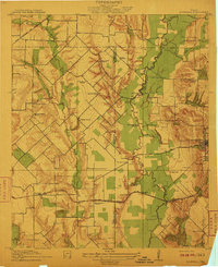
Editions of this 1912 Rockwall Map
2 editions found
Historical Maps of Dallas Through Time
8 maps found
Featured Locations
Source Details
SourceU.S. Geological Survey
CopyrightPublic Domain