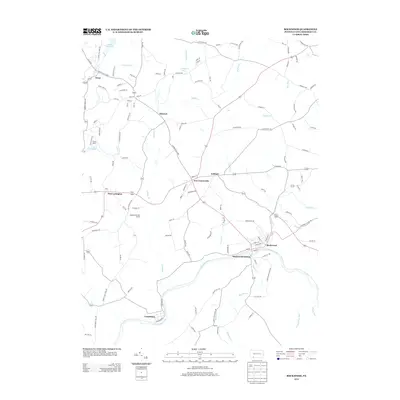
2013 Map of Rockwood
USGS Topo · Published 2013About this map
Rockwood sits at the confluence of several vital waterways in Somerset County, where Coxes Cr and Wilson Cr meet the Casselman River. This 2013 survey highlights a landscape defined by the deep winding valleys of the Laurel Highlands, centered on the transit hub of Rockwood Station. The area's settlement pattern follows the high ridges and valley floors, with small communities like New Centerville, New Lexington, and Gebhart linked by a complex network of local roads including the Copper Kettle Hwy. To the northwest, recreational and summer landmarks such as Camp Soles, Laurel Hill Lake, and Triss Lake indicate the region's shift toward conservation and leisure. Traces of the area's industrial past remain visible through features like Railroad Ave in Casselman, marking the historic rail corridors that once fueled the local economy along the riverbanks.
Find a feature on this map
126 named features on this map. Tap any name to fly to it.
Don’t see what you’re looking for? This feature index may not catch every label — zoom into the map to look around manually.
Map Details
Editions of this 2013 Rockwood Map
This is the sole edition of this map. No revisions or reprints were ever made.
Other maps of this area

1913 · Somerset
USGS Topo · 1:62,500

1915 · Somerset
USGS Topo · 1:62,500

1921 · Meyersdale
USGS Topo · 1:62,500

1922 · Confluence
USGS Topo · 1:62,500

1922 · Donegal
USGS Topo · 1:62,500

1931 · Confluence
USGS Topo · 1:62,500

1933 · Confluence
USGS Topo · 1:62,500

1935 · Donegal
USGS Topo · 1:62,500

1939 · Meyersdale
USGS Topo · 1:62,500

1944 · Somerset
USGS Topo · 1:62,500