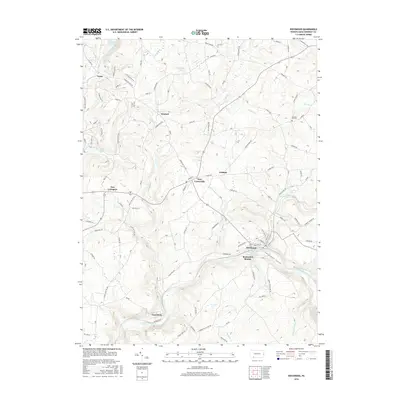
2016 Map of Rockwood
USGS Topo · Published 2016About this map
Rockwood and the dramatic Casselman Gorge define this portion of Somerset County, where the Casselman River carves a deep path through the highlands. The settlement at Rockwood Station serves as a reminder of the corridor's long history as a transportation hub for the region's coal and timber. High-elevation features like Lost Mountain and water bodies including Laurel Hill Lake and Chippewa Lake characterize the western reaches of the sheet, while small rural communities like Kimmel, New Centerville, and New Lexington are linked by a network of historic routes including Copper Kettle Hwy and W Mud Pike. Genealogists may find interest in the Pleasant Hill Cem located near the eastern edge, as well as the numerous family-named roads that crisscross the agricultural and wooded terrain.
Find a feature on this map
99 named features on this map. Tap any name to fly to it.
Don’t see what you’re looking for? This feature index may not catch every label — zoom into the map to look around manually.
Map Details
Editions of this 2016 Rockwood Map
This is the sole edition of this map. No revisions or reprints were ever made.
Other maps of this area

1913 · Somerset
USGS Topo · 1:62,500

1915 · Somerset
USGS Topo · 1:62,500

1921 · Meyersdale
USGS Topo · 1:62,500

1922 · Confluence
USGS Topo · 1:62,500

1922 · Donegal
USGS Topo · 1:62,500

1931 · Confluence
USGS Topo · 1:62,500

1933 · Confluence
USGS Topo · 1:62,500

1935 · Donegal
USGS Topo · 1:62,500

1939 · Meyersdale
USGS Topo · 1:62,500

1944 · Somerset
USGS Topo · 1:62,500