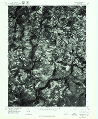
1977 Map of Rockwood
USGS Topo · Published 1979About this map
Rockwood serves as the primary hub of activity in this Somerset County landscape, situated along the distinctive bend of the Casselman River. The 1977 aerial imagery provides a clear look at the agricultural patterns defining the region, where contoured fields wrap around the slopes of Laurel Hill. The settlement at New Centerville anchors the central high ground, while the smaller community of Casselman sits further west along the riverbank. Significant water features like Chippewa Lake and the winding Coxes Creek dictate the local geography. This orthophotoquad captures the transition between the established riverfront towns and the surrounding rural uplands at Trent and New Lexington, documenting the precise footprint of these Pennsylvania communities in the late 1970s.
Find a feature on this map
10 named features on this map. Tap any name to fly to it.
Don’t see what you’re looking for? This feature index may not catch every label — zoom into the map to look around manually.
Map Details
Editions of this 1977 Rockwood Map
This is the sole edition of this map. No revisions or reprints were ever made.
Other maps of this area

1913 · Somerset
USGS Topo · 1:62,500

1915 · Somerset
USGS Topo · 1:62,500

1921 · Meyersdale
USGS Topo · 1:62,500

1922 · Confluence
USGS Topo · 1:62,500

1922 · Donegal
USGS Topo · 1:62,500

1931 · Confluence
USGS Topo · 1:62,500

1933 · Confluence
USGS Topo · 1:62,500

1935 · Donegal
USGS Topo · 1:62,500

1939 · Meyersdale
USGS Topo · 1:62,500

1944 · Somerset
USGS Topo · 1:62,500