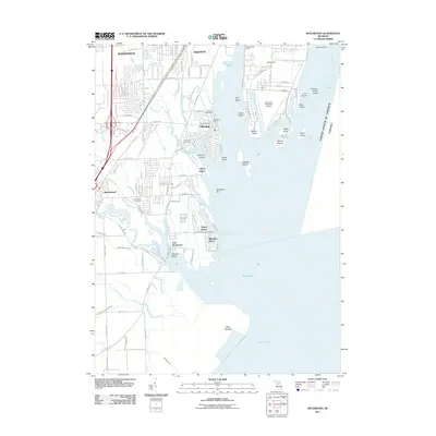
2011 Map of Rockwood
USGS Topo · Published 2011About this map
Lake Erie and the Detroit River converge in this shoreline study of the Downriver region, where the international boundary between the United States of America and Canada follows the river's deep channels. The landscape is defined by an intricate network of waterways and islands, including Grosse Ile Municipal Airport situated near Elba Island and Meso Island. Inland, the residential patterns of Rockwood, Gibraltar, and Woodhaven are intersected by the Canadian National rail line and numerous drainage systems like the Frank and Poet Drain.
Find a feature on this map
73 named features on this map. Tap any name to fly to it.
Don’t see what you’re looking for? This feature index may not catch every label — zoom into the map to look around manually.
Map Details
Editions of this 2011 Rockwood Map
This is the sole edition of this map. No revisions or reprints were ever made.
Other maps of this area

1906 · Wyandotte
USGS Topo · 1:62,500

1906 · Romulus
USGS Topo · 1:62,500

1912 · Wyandotte
USGS Topo · 1:62,500

1912 · Monroe
USGS Topo · 1:62,500

1914 · Monroe
USGS Topo · 1:62,500

1928 · Romulus
USGS Topo · 1:62,500

1929 · Wyandotte
USGS Topo · 1:62,500

1936 · Wyandotte
USGS Topo · 1:31,680

1936 · Rockwood
USGS Topo · 1:31,680

1936 · Stony Point
USGS Topo · 1:31,680