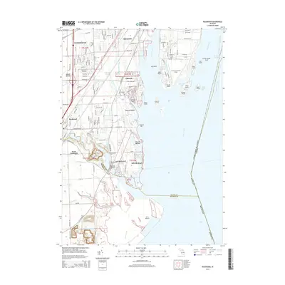
2014 Map of Rockwood
USGS Topo · Published 2014About this map
The Huron River flows into the western edge of Lake Erie, defining the landscape of this coastal Wayne and Monroe County region. The map captures the intricate shoreline and island chains of the Detroit River outlet, including Celeron Island, Hickory Island, and Swan Island. Coastal settlements such as Gibraltar, Maple Beach, and Cherry Island are shown amidst a network of drainage canals and creeks like the Frank and Poet Drain and Mouille Creek. This survey provides a clear view of the industrial and residential development south of Trenton, where inland features like Quarry Lake and the Conrail railroad lines interface with the marshy grounds of Point Mouille. Local history is preserved through the inclusion of several burial sites, such as Saint Marys Cem and Gibraltar Cem, alongside infrastructure like the Grosse Ile Municipal Airport.
Find a feature on this map
145 named features on this map. Tap any name to fly to it.
Don’t see what you’re looking for? This feature index may not catch every label — zoom into the map to look around manually.
Map Details
Editions of this 2014 Rockwood Map
This is the sole edition of this map. No revisions or reprints were ever made.
Other maps of this area

1906 · Wyandotte
USGS Topo · 1:62,500

1906 · Romulus
USGS Topo · 1:62,500

1912 · Wyandotte
USGS Topo · 1:62,500

1912 · Monroe
USGS Topo · 1:62,500

1914 · Monroe
USGS Topo · 1:62,500

1928 · Romulus
USGS Topo · 1:62,500

1929 · Wyandotte
USGS Topo · 1:62,500

1936 · Wyandotte
USGS Topo · 1:31,680

1936 · Rockwood
USGS Topo · 1:31,680

1936 · Stony Point
USGS Topo · 1:31,680