Loading...
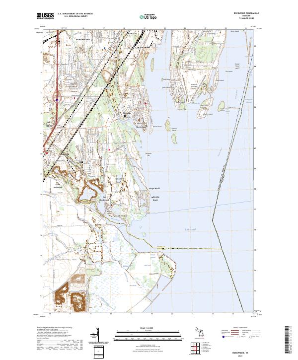
Loading map...2023 Map of Rockwood
USGS Topo · Published 2023About this map
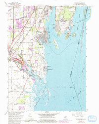
The Huron River serves as the focal point for the border between Wayne and Monroe Counties, winding past the established communities of Rockwood and South Rockwood. This coastal landscape is defined by the complex transition from mainland to the Detroit River islands, including Meso Island and Hickory Island, while the massive Detroit River International Wildlife Refuge encompasses vast wetland areas like Mouille March.
Find a feature on this map
92 named features on this map. Tap any name to fly to it.
Don’t see what you’re looking for? This feature index may not catch every label — zoom into the map to look around manually.
Map Details
Date Portrayed2023
Date Published2023
PublisherU.S. Geological Survey
Map TypeTopographic
Scale1:24000
Physical Dimensions24 x 29 inches
Editions of this 2023 Rockwood Map
This is the sole edition of this map. No revisions or reprints were ever made.
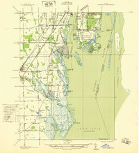
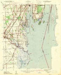
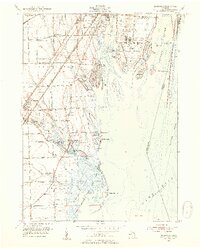
Historical Maps of Milleville Beach Through Time
5 maps found
Featured Locations
Source Details
SourceU.S. Geological Survey
CopyrightPublic Domain