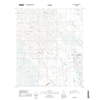
2018 Map of Rocky Branch
USGS Topo · Published 2018About this map
Bayou de Loutre meanders through the wetlands of northern Louisiana, defining a landscape shaped by the shifting waters of the Ouachita River basin. Near the settlement of Spencer, the terrain is a complex network of seasonal lakes and islands, including Phillips Lake, Long Point Island, and Tenmile Island. The map documents the boundary where Union Parish and Ouachita Parish meet, a region characterized by timbered lowlands and numerous small bayous such as Bayou D'Arbonne and Rufus Br.
Find a feature on this map
81 named features on this map. Tap any name to fly to it.
Don’t see what you’re looking for? This feature index may not catch every label — zoom into the map to look around manually.
Map Details
Editions of this 2018 Rocky Branch Map
This is the sole edition of this map. No revisions or reprints were ever made.
Other maps of this area

1935 · Drew
USGS Topo · 1:62,500

1935 · Haile
USGS Topo · 1:62,500

1952 · Calhoun
USGS Topo · 1:62,500

1952 · Farmerville
USGS Topo · 1:62,500

1955 · Shreveport
USGS Topo · 1:250,000

1956 · Shreveport
USGS Topo · 1:250,000

1956 · Haile
USGS Topo · 1:62,500

1957 · Monroe North
USGS Topo · 1:62,500

1957 · West Monroe North
USGS Topo · 1:24,000
1957 · Monroe North
USGS Topo · 1:24,000