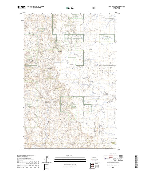
2024 Map of Rocky Ridge North
USGS Topo · Published 2024About this map
Little Missouri National Grassland dominates this section of the North Dakota badlands, where the drainage network of the South Branch Heart River and various forks of Bull Creek have carved a complex topography. The landscape is defined by its prominent landmarks, including Flat Top Butte and the aptly named Windy Butte. These landforms provided essential orientation for early travelers and ranchers in a region characterized by massive open ranges and minimal permanent settlement.
Find a feature on this map
36 named features on this map. Tap any name to fly to it.
Don’t see what you’re looking for? This feature index may not catch every label — zoom into the map to look around manually.
Map Details
Editions of this 2024 Rocky Ridge North Map
This is the sole edition of this map. No revisions or reprints were ever made.
Other maps of this area

1953 · Dickinson
USGS Topo · 1:250,000

1957 · Dickinson
USGS Topo · 1:250,000

1961 · Daglum
USGS Topo · 1:62,500

1961 · Rocky Ridge
USGS Topo · 1:62,500

1962 · Tracy Mountain
USGS Topo · 1:24,000

1962 · Belfield SW
USGS Topo · 1:24,000

1962 · Fryburg
USGS Topo · 1:24,000

1980 · Belfield
USGS Topo · 1:100,000
1982 · Daglum NW
USGS Topo · 1:24,000
1982 · Daglum SW
USGS Topo · 1:24,000