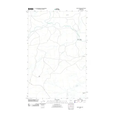
2011 Map of Rocky Ridge
USGS Topo · Published 2011About this map
The Blackfeet Indian Reservation boundary cuts through this corner of Montana, where the terrain is defined by the winding course of the Two Medicine River. The settlement of Hagans Crossing sits near the confluence of the river and Kipps Coulee, a focal point for local transit and history. To the north, the broad expanse of Hagan Flat contrasts with the prominent elevation of Flag Butte and the namesake Rocky Ridge to the southwest. This landscape is a network of coulees and creeks, including Badger Creek and Rocky Ridge Coulee, which dictate the paths of local routes such as Lenoir Rd and the J Wolsted road. The survey documents a sparsely populated region where the physical geography of the river valley remains the primary influence on settlement patterns and land use.
Find a feature on this map
11 named features on this map. Tap any name to fly to it.
Don’t see what you’re looking for? This feature index may not catch every label — zoom into the map to look around manually.
Map Details
Editions of this 2011 Rocky Ridge Map
This is the sole edition of this map. No revisions or reprints were ever made.
Other maps of this area

1907 · Blackfoot Res.
USGS Topo · 1:48,000

1909 · Cut Bank
USGS Topo · 1:125,000

1911 · Blackfoot
USGS Topo · 1:125,000

1912 · Cut Bank
USGS Topo · 1:125,000

1914 · Heart Butte
USGS Topo · 1:125,000

1918 · Heart Butte
USGS Topo · 1:125,000

1920 · Dupuyer
USGS Topo · 1:125,000

1934 · Lake Frances
USGS Topo · 1:48,000

1937 · Lake Frances
USGS Topo · 1:62,500

1960 · Cut Bank
USGS Topo · 1:250,000