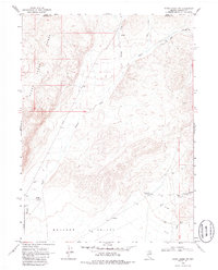
1968 Map of Rodeo Creek NW
USGS Topo · Published 1986About this map
Boulder Valley serves as a remote focal point for this late-1960s study of the high desert terrain where the Sheep Range rises from the basin floor. The landscape is defined by its arid hydrology, featuring intermittent drainage systems like Boulder Creek, Rodeo Creek, and Bell Creek. Human activity is sparse but specific to the ranching and resource extraction industries of the era, evidenced by the Boulder Windmill Corral and Sheep Creek Windmill Corral which provided essential water for livestock. Industrial infrastructure is noted through a long Aqueduct in the south and scattered signs of exploration such as a Prospect and several Gravel Pits. The map captures a moment when primitive Jeep Trails and Private roads were the primary means of navigating this transition between the Elko and Eureka county lines, documenting a topography shaped more by water rights and range management than urban development.
Find a feature on this map
17 named features on this map. Tap any name to fly to it.
Don’t see what you’re looking for? This feature index may not catch every label — zoom into the map to look around manually.
Map Details
Editions of this 1968 Rodeo Creek NW Map
3 editions found

Other maps of this area

1955 · McDermitt
USGS Topo · 1:250,000

1955 · Winnemucca
USGS Topo · 1:250,000

1958 · Winnemucca
USGS Topo · 1:250,000

1959 · McDermitt
USGS Topo · 1:250,000

1962 · Winnemucca
USGS Topo · 1:250,000

1965 · Sheep Creek Range NE
USGS Topo · 1:24,000

1965 · Sheep Creek Range SE
USGS Topo · 1:24,000
1965 · Willow Creek Reservoir SE
USGS Topo · 1:24,000

1968 · Rodeo Creek SW
USGS Topo · 1:24,000

1968 · Rodeo Creek NE
USGS Topo · 1:24,000