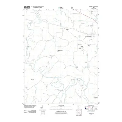
2011 Map of Rodney
USGS Topo · Published 2011About this map
Raccoon Creek carves a winding path through this corner of Gallia County, serving as the primary geographic anchor for numerous small communities and family-named landmarks. The landscape is defined by its transition from traditional crossroads settlements like Adamsville and Cora to more contemporary residential developments such as Fairfield Acres, The Meadows, and Park Lane Subdivision. Local heritage is preserved in the numerous burial grounds scattered across the terrain, including Adamsville Cemetery, Lowry Cemetery, and the Centenary Cemetery near the village of Centenary.
Find a feature on this map
114 named features on this map. Tap any name to fly to it.
Don’t see what you’re looking for? This feature index may not catch every label — zoom into the map to look around manually.
Map Details
Editions of this 2011 Rodney Map
This is the sole edition of this map. No revisions or reprints were ever made.
Other maps of this area

1906 · Bidwell
USGS Topo · 1:62,500

1906 · Athalia
USGS Topo · 1:62,500

1906 · Glenwood
USGS Topo · 1:62,500

1908 · Bidwell
USGS Topo · 1:62,500

1908 · Athalia
USGS Topo · 1:62,500

1908 · Glenwood
USGS Topo · 1:62,500

1908 · Point Pleasant
USGS Topo · 1:62,500

1926 · Point Pleasant
USGS Topo · 1:62,500

1929 · Point Pleasant
USGS Topo · 1:62,500

1957 · Huntington
USGS Topo · 1:250,000