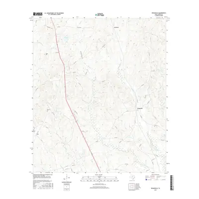
2016 Map of Roganville
USGS Topo · Published 2016About this map
The town of Roganville and the settlement at Erin anchor this Jasper County landscape, defined by a dense network of creek drainages and timbered rises. The terrain is notably dissected by watercourses like Thickety Cr and Everett Cr, which flow toward the lower bottomlands. Family history is well-preserved through several burial sites scattered across the township, including Boyett Cem near the western edge and McLemore Cem further north.
Find a feature on this map
57 named features on this map. Tap any name to fly to it.
Don’t see what you’re looking for? This feature index may not catch every label — zoom into the map to look around manually.
Map Details
Editions of this 2016 Roganville Map
This is the sole edition of this map. No revisions or reprints were ever made.
Other maps of this area

1952 · Lake Charles
USGS Topo · 1:250,000

1954 · Lake Charles
USGS Topo · 1:250,000

1954 · Beaumont
USGS Topo · 1:250,000

1955 · Roganville
USGS Topo · 1:62,500

1955 · Curtis
USGS Topo · 1:62,500

1957 · Beaumont
USGS Topo · 1:250,000

1958 · Spurger
USGS Topo · 1:62,500

1958 · Kirbyville
USGS Topo · 1:62,500

1984 · Beaumont
USGS Topo · 1:250,000
1984 · Jamestown
USGS Topo · 1:24,000