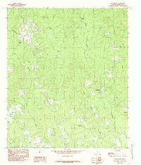
1984 Map of Roganville
USGS Topo · Published 1985About this map
Roganville stands as a central point of reference in this mid-1970s look at Jasper County, where small rural settlements are linked by a complex network of timbered drainages. The landscape is defined by its watercourses, including Big Creek and Thickety Creek, which carve through the terrain between local elevations like Bald Hill and Zion Hill. Notable for genealogists are the scattered communities of Erin, Eclipse, and Everett, along with a local Cem that indicates established family sites in the region.
Find a feature on this map
21 named features on this map. Tap any name to fly to it.
Don’t see what you’re looking for? This feature index may not catch every label — zoom into the map to look around manually.
Map Details
Editions of this 1984 Roganville Map
This is the sole edition of this map. No revisions or reprints were ever made.
Other maps of this area

1952 · Lake Charles
USGS Topo · 1:250,000

1954 · Lake Charles
USGS Topo · 1:250,000

1954 · Beaumont
USGS Topo · 1:250,000

1955 · Roganville
USGS Topo · 1:62,500

1955 · Curtis
USGS Topo · 1:62,500

1957 · Beaumont
USGS Topo · 1:250,000

1958 · Spurger
USGS Topo · 1:62,500

1958 · Kirbyville
USGS Topo · 1:62,500

1984 · Beaumont
USGS Topo · 1:250,000
1984 · Jamestown
USGS Topo · 1:24,000