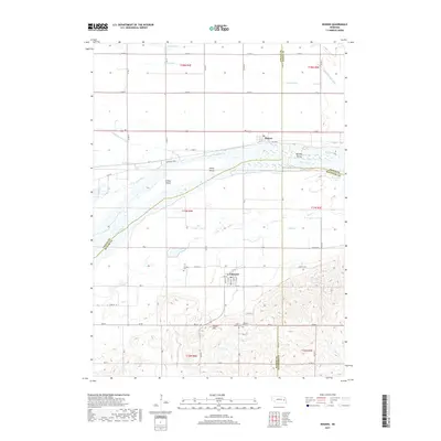
2017 Map of Rogers
USGS Topo · Published 2017About this map
The Platte River valley dominates this landscape, serving as a boundary between several Nebraska counties and shaping the local topography with its broad, braided channel and numerous islands like School Island and Murphy Island. North of the river, the settlement of Rogers sits on level ground drained by a complex network of channels including Byrne Ditch and O'Hare Ditch. This drainage system highlights the intensive agricultural management of the fertile bottomlands.
Find a feature on this map
51 named features on this map. Tap any name to fly to it.
Don’t see what you’re looking for? This feature index may not catch every label — zoom into the map to look around manually.
Map Details
Editions of this 2017 Rogers Map
This is the sole edition of this map. No revisions or reprints were ever made.
Other maps of this area

1899 · Wahoo
USGS Topo · 1:125,000

1899 · David City
USGS Topo · 1:125,000

1955 · Fremont
USGS Topo · 1:250,000

1957 · Fremont
USGS Topo · 1:250,000

1958 · Fremont
USGS Topo · 1:250,000

1966 · Webster
USGS Topo · 1:24,000

1966 · Dodge SW
USGS Topo · 1:24,000
1966 · Clarkson SE
USGS Topo · 1:24,000

1968 · Bruno
USGS Topo · 1:24,000
1968 · Schuyler
USGS Topo · 1:24,000