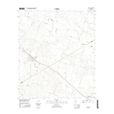
2016 Map of Rogers
USGS Topo · Published 2016About this map
The town of Rogers serves as the primary hub in this central Texas landscape, positioned where the Bell Co Milam Co boundary meets a network of rural roads. The area's agricultural character is defined by the drainage systems of Lipan Cr, Big Elm Cr, and the smaller Super Br which feed into the surrounding countryside. This 2016 survey documents a territory punctuated by small family and community burial grounds, including the McCann Cem, Taplin View Cem, and the Wedel Cemetery further north near Leedale. Outside the main town, smaller settlements like South Elm and Edgeworth remain connected by farm-to-market roads and county lanes. The presence of features such as Wolfe Field and Dry Hollow reflects the local nomenclature and topographic variations of this prairie region, providing a clear record of land use and property boundaries in the early 21st century.
Find a feature on this map
73 named features on this map. Tap any name to fly to it.
Don’t see what you’re looking for? This feature index may not catch every label — zoom into the map to look around manually.
Map Details
Editions of this 2016 Rogers Map
This is the sole edition of this map. No revisions or reprints were ever made.
Other maps of this area

1885 · Taylor
USGS Topo · 1:125,000

1887 · Taylor
USGS Topo · 1:125,000

1892 · Temple
USGS Topo · 1:125,000

1894 · Taylor
USGS Topo · 1:125,000

1910 · Buckholts
USGS Topo · 1:24,000

1912 · Buckholts
USGS Topo · 1:31,680

1931 · Belton
USGS Topo · 1:62,500

1954 · Waco
USGS Topo · 1:250,000

1954 · Austin
USGS Topo · 1:250,000

1955 · Waco
USGS Topo · 1:250,000