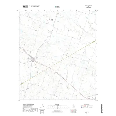
2019 Map of Rogers
USGS Topo · Published 2019About this map
The town of Rogers serves as the central hub of this landscape, situated near the southwestern border of Bell and Milam Counties. The area is defined by a dendritic network of creeks, including S Elm Cr and Lipan Cr, which drain the agricultural terrain toward the southeast. Small rural communities like Leedale and Edgeworth are connected by a grid of farm-to-market roads and county routes, reflecting the region's enduring ranching and farming character. For genealogists, the map provides precise locations for several local burial sites, such as Taplin View Cem, McCann Cem, and the Rogers Cem south of the main town. The southeastern corner shows the edge of Buckholts, where Hope Cem sits near the Milam County line, illustrating the close-knit proximity of these historic Central Texas settlements.
Find a feature on this map
72 named features on this map. Tap any name to fly to it.
Don’t see what you’re looking for? This feature index may not catch every label — zoom into the map to look around manually.
Map Details
Editions of this 2019 Rogers Map
This is the sole edition of this map. No revisions or reprints were ever made.
Other maps of this area

1885 · Taylor
USGS Topo · 1:125,000

1887 · Taylor
USGS Topo · 1:125,000

1892 · Temple
USGS Topo · 1:125,000

1894 · Taylor
USGS Topo · 1:125,000

1910 · Buckholts
USGS Topo · 1:24,000

1912 · Buckholts
USGS Topo · 1:31,680

1931 · Belton
USGS Topo · 1:62,500

1954 · Waco
USGS Topo · 1:250,000

1954 · Austin
USGS Topo · 1:250,000

1955 · Waco
USGS Topo · 1:250,000