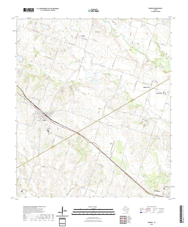
2022 Map of Rogers
USGS Topo · Published 2022About this map
The BNSF Railway cuts a diagonal path through this Central Texas landscape, connecting the town of Rogers with Buckholts to the southeast. Positioned along the border of Bell Co and Milam Co, this map reveals a patchwork of agricultural fields and rural homesteads linked by an extensive network of county roads. Genealogical researchers will find significant detail in the cluster of burial sites near the town center, including Rogers Cem West and Rogers Cem East, alongside outlying locations like McCann Cem and South Elm Cem.
Find a feature on this map
74 named features on this map. Tap any name to fly to it.
Don’t see what you’re looking for? This feature index may not catch every label — zoom into the map to look around manually.
Map Details
Editions of this 2022 Rogers Map
This is the sole edition of this map. No revisions or reprints were ever made.
Other maps of this area

1885 · Taylor
USGS Topo · 1:125,000

1887 · Taylor
USGS Topo · 1:125,000

1892 · Temple
USGS Topo · 1:125,000

1894 · Taylor
USGS Topo · 1:125,000

1910 · Buckholts
USGS Topo · 1:24,000

1912 · Buckholts
USGS Topo · 1:31,680

1931 · Belton
USGS Topo · 1:62,500

1954 · Waco
USGS Topo · 1:250,000

1954 · Austin
USGS Topo · 1:250,000

1955 · Waco
USGS Topo · 1:250,000