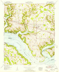
1952 Map of Rogersville
USGS Topo · Published 1957About this map
Wheeler Lake dominates this landscape, where the confluence with the Elk River meets the heavy infrastructure of the Wheeler Dam area. Published in the early 1950s, the map reveals a post-New Deal Tennessee Valley geography defined by large-scale hydroelectric development and the expansion of Joe Wheeler State Park. The town of Rogersville sits inland as a central hub, while the surrounding countryside is densely marked by small communities and family burial grounds like McCartney Cem and Oliver Cem.
Find a feature on this map
73 named features on this map. Tap any name to fly to it.
Don’t see what you’re looking for? This feature index may not catch every label — zoom into the map to look around manually.
Map Details
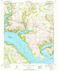
Editions of this 1952 Rogersville Map
2 editions found
Other maps of this area

1914 · Rogersville
USGS Topo · 1:48,000

1916 · Rogersville
USGS Topo · 1:62,500

1936 · Union Hill
USGS Topo · 1:24,000

1936 · Thorntontown
USGS Topo · 1:24,000

1936 · Courtland
USGS Topo · 1:24,000

1936 · Lexington
USGS Topo · 1:24,000

1936 · Hillsboro
USGS Topo · 1:24,000

1936 · Wheeler Dam
USGS Topo · 1:24,000

1936 · Town Creek
USGS Topo · 1:24,000
1936 · Center Hill
USGS Topo · 1:24,000