
1966 Map of Roll SE
USGS Topo · Published 1967About this map
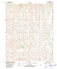
The Canadian River flows across the northern portion of this landscape, marking a prominent boundary through the rolling plains of western Oklahoma. The area is defined by its rural character and extensive drainage network, with Quartermaster Creek and Ninemile Creek cutting through the terrain. Significant for genealogists and local historians, the sheet identifies isolated community anchors like the Lone Bell Cem and Rhome Cem, alongside the Three Corner Sch. These markers of early settlement are situated within historic townships and districts including Streeter, Rawdon, and Grand. The topography is punctuated by Benham Hill, overlooking various branches of the Sourdough Creek system and Spotted Deer Creek.
Find a feature on this map
17 named features on this map. Tap any name to fly to it.
Don’t see what you’re looking for? This feature index may not catch every label — zoom into the map to look around manually.
Map Details
Editions of this 1966 Roll SE Map
This is the sole edition of this map. No revisions or reprints were ever made.
Other maps of this area

1955 · Clinton
USGS Topo · 1:250,000

1957 · Clinton
USGS Topo · 1:250,000

1960 · Cheyenne
USGS Topo · 1:62,500

1960 · Hammon
USGS Topo · 1:62,500

1961 · Leedey
USGS Topo · 1:62,500

1965 · Roll NE
USGS Topo · 1:24,000

1965 · Roll NW
USGS Topo · 1:24,000

1966 · Roll
USGS Topo · 1:24,000

1984 · Foss Reservoir
USGS Topo · 1:100,000
1987 · Leedey SW
USGS Topo · 1:24,000