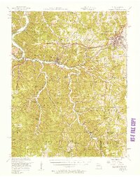
1951 Map of Rolla
USGS Topo · Published 1958About this map
Rolla serves as the focal point of this mid-century Missouri interior, anchored by the Missouri School of Mines and the crossing of Route 66 and Highway 63. The St Louis-San Francisco railroad cuts through the Ozark landscape, connecting the transit hubs of Newburg, Arlington, and Jerome. The rugged geography is defined by the Gasconade River and its tributaries, where landmarks like Devils Backbone and Table Rock rise above the valleys.
Find a feature on this map
101 named features on this map. Tap any name to fly to it.
Don’t see what you’re looking for? This feature index may not catch every label — zoom into the map to look around manually.
Map Details
Editions of this 1951 Rolla Map
3 editions found
Other maps of this area

1888 · Tuscumbia
USGS Topo · 1:125,000

1894 · Tuscumbia
USGS Topo · 1:125,000

1912 · Rolla
USGS Topo · 1:62,500

1928 · Meramec Spring
USGS Topo · 1:62,500

1934 · Redbird
USGS Topo · 1:62,500

1936 · Waynesville
USGS Topo · 1:48,000

1937 · Edgar Springs
USGS Topo · 1:48,000

1937 · Vienna
USGS Topo · 1:62,500

1938 · Redbird
USGS Topo · 1:62,500

1938 · Vienna
USGS Topo · 1:48,000