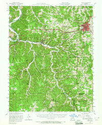
1951 Map of Rolla
USGS Topo · Published 1965About this map
The St Louis-San Francisco railroad cuts a vital path through the center of this Ozark landscape, connecting the growing hub of Rolla with the river towns of Newburg and Jerome. The regional infrastructure of the early 1950s is on full display, from the Missouri Trachoma Hospital in the county seat to the scattered rural schoolhouses like Wynn School and the Western Star School (abandoned). This survey captures a moment of transition where traditional timber and mining activities, evidenced by the Beaver Creek Mine and Corn Creek Lookout Tower, coexist with the expansion of the Mark Twain National Forest. The map documents numerous family-centric landmarks, including the Roach Cemetery and Strawhun Cemetery, which provide invaluable touchstones for genealogists tracing the early settlers of Phelps County and the surrounding river hollows.
Find a feature on this map
81 named features on this map. Tap any name to fly to it.
Don’t see what you’re looking for? This feature index may not catch every label — zoom into the map to look around manually.
Map Details
Editions of this 1951 Rolla Map
3 editions found
Other maps of this area

1888 · Tuscumbia
USGS Topo · 1:125,000

1894 · Tuscumbia
USGS Topo · 1:125,000

1912 · Rolla
USGS Topo · 1:62,500

1928 · Meramec Spring
USGS Topo · 1:62,500

1934 · Redbird
USGS Topo · 1:62,500

1936 · Waynesville
USGS Topo · 1:48,000

1937 · Edgar Springs
USGS Topo · 1:48,000

1937 · Vienna
USGS Topo · 1:62,500

1938 · Redbird
USGS Topo · 1:62,500

1938 · Vienna
USGS Topo · 1:48,000