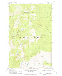
1967 Map of Roman Nose
USGS Topo · Published 1978About this map
Roman Nose Lookout stands at the southern heights of this high-elevation landscape, overlooking a series of glacial basins within the Kaniksu National Forest. In the late 1960s, this area of Boundary County was defined by its protected status and seasonal access, including a large State Game Preserve spanning the northern half of the quadrangle. The map reveals a high-altitude network of small alpine bodies of water such as Roman Nose Lakes, Cooks Lake, and Bottleneck Lake. A primary Campground near the Roman Nose massif serves as a hub for the various Jeep Trails that traverse the ridges. The drainage patterns are clearly established by several steep watercourses, including Myrtle Creek and Caribou Creek, which flow through the deep valleys between Snow Ridge and Caribou Ridge.
Find a feature on this map
37 named features on this map. Tap any name to fly to it.
Don’t see what you’re looking for? This feature index may not catch every label — zoom into the map to look around manually.
Map Details
Editions of this 1967 Roman Nose Map
2 editions found
Other maps of this area

1911 · Priest Lake
USGS Topo · 1:250,000

1913 · Priest Lake
USGS Topo · 1:250,000

1958 · Sandpoint
USGS Topo · 1:250,000

1963 · Sandpoint
USGS Topo · 1:250,000

1965 · Farnham Peak
USGS Topo · 1:24,000

1965 · Moravia
USGS Topo · 1:24,000

1965 · Naples
USGS Topo · 1:24,000

1967 · The Wigwams
USGS Topo · 1:24,000
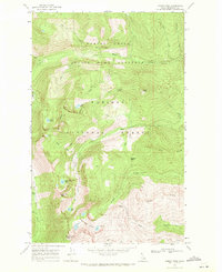
1967 · Roman Nose
USGS Topo · 1:24,000

1967 · Mount Roothaan
USGS Topo · 1:24,000