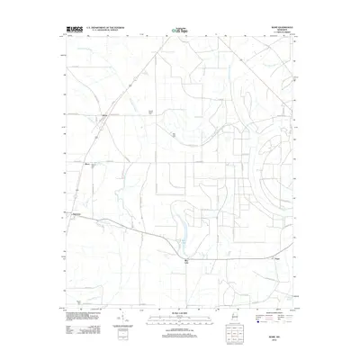
2012 Map of Rome
USGS Topo · Published 2012About this map
Rome serves as a central hub in this section of the Mississippi Delta, where the landscape is defined by a dense network of drainage canals and natural waterways. The geography reflects the region's long-standing agricultural focus, with settlements like Minot and Flautt situated among a complex of named bayous including Bear Bayou, Homecypress Bayou, and Wild Bill Bayou. The map captures a detailed distribution of community landmarks, particularly the numerous cemeteries such as Second Baptist Cem, New Light Cem, and Pleasant Green Cem, which provide essential points of reference for local family history and genealogy. Large natural features like Blue Lake and the winding Upper Quiver River interrupt the geometric grid of farm roads such as Rudolph Smith Rd and Hittspur Rd, illustrating the persistence of Delta wetlands like Staten Brake alongside developed land.
Find a feature on this map
55 named features on this map. Tap any name to fly to it.
Don’t see what you’re looking for? This feature index may not catch every label — zoom into the map to look around manually.
Map Details
Editions of this 2012 Rome Map
This is the sole edition of this map. No revisions or reprints were ever made.
Other maps of this area

1931 · Sumner
USGS Topo · 1:48,000

1931 · Drew
USGS Topo · 1:48,000

1932 · Tutwiler
USGS Topo · 1:48,000

1935 · Clarksdale
USGS Topo · 1:62,500

1935 · Sumner
USGS Topo · 1:62,500

1935 · Tutwiler
USGS Topo · 1:62,500

1935 · Mound Bayou
USGS Topo · 1:62,500

1939 · Sumner
USGS Topo · 1:62,500

1939 · Tutwiler
USGS Topo · 1:62,500

1939 · Clarksdale
USGS Topo · 1:62,500