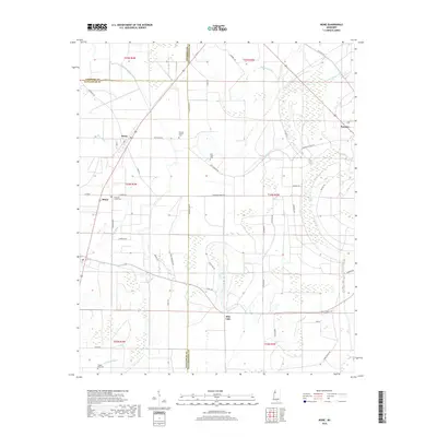
2018 Map of Rome
USGS Topo · Published 2018About this map
Rome and the smaller settlement of Minot anchor this portion of the Mississippi Delta, where the landscape is defined by the slow-moving waters of Homecypress Bayou and Bear Bayou. The map reveals a rural community structured around agriculture and small-town nodes, connected by a network of local roads like Patterson Rd and Friendship West Rd. The eastern edge of the survey transitions into the drainage of the Upper Quiver River and Lower Quiver River near the town of Sumner.
Find a feature on this map
58 named features on this map. Tap any name to fly to it.
Don’t see what you’re looking for? This feature index may not catch every label — zoom into the map to look around manually.
Map Details
Editions of this 2018 Rome Map
This is the sole edition of this map. No revisions or reprints were ever made.
Other maps of this area

1931 · Sumner
USGS Topo · 1:48,000

1931 · Drew
USGS Topo · 1:48,000

1932 · Tutwiler
USGS Topo · 1:48,000

1935 · Clarksdale
USGS Topo · 1:62,500

1935 · Sumner
USGS Topo · 1:62,500

1935 · Tutwiler
USGS Topo · 1:62,500

1935 · Mound Bayou
USGS Topo · 1:62,500

1939 · Sumner
USGS Topo · 1:62,500

1939 · Tutwiler
USGS Topo · 1:62,500

1939 · Clarksdale
USGS Topo · 1:62,500