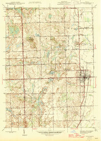
1945 Map of Romeo
USGS Topo · Published 1945About this map
Romeo sits at the eastern edge of this mid-1940s landscape, serving as a hub for the surrounding rural townships of Bruce and Washington. The area's agricultural and social character is defined by a dense network of country schools, including Shady Lawn Sch and Clifton Sch, alongside small community graveyards like Mc Cafferty Cem. Local industry and movement revolve around the Grand Trunk Western railroad and the Stony Creek drainage basin, where Clifton Mill indicates a history of water-powered milling near East Mill Lake. The terrain transitions from the low-lying East Pond and various kettle lakes to higher points like Twombly Mtn. This survey captures the transition of the Macomb and Oakland county line during an era when the landscape was still primarily composed of family farms and small rural institutions like the Simpson Park Camp Ground.
Find a feature on this map
54 named features on this map. Tap any name to fly to it.
Don’t see what you’re looking for? This feature index may not catch every label — zoom into the map to look around manually.
Map Details
Editions of this 1945 Romeo Map
2 editions found

Other maps of this area

1908 · Rochester
USGS Topo · 1:62,500

1912 · Mt Clemens
USGS Topo · 1:62,500

1914 · Armada
USGS Topo · 1:62,500

1928 · Armada
USGS Topo · 1:62,500

1929 · Mt Clemens
USGS Topo · 1:62,500

1936 · Rochester
USGS Topo · 1:31,680

1936 · Washington
USGS Topo · 1:31,680

1936 · Waldenburg
USGS Topo · 1:31,680

1943 · Lake Orion
USGS Topo · 1:24,000

1943 · Romeo
USGS Topo · 1:24,000
Featured Places
- Washington Charter Township, MI
- Oakland Charter Township, MI
- Addison Township, MI
- Romeo, MI
- Clifton Mill, Washington Charter Township