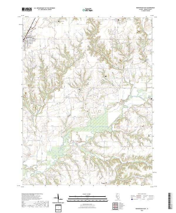
2024 Map of Roodhouse East
USGS Topo · Published 2024About this map
Roodhouse and the smaller settlement of Wrights anchor this Greene County landscape, defined by a complex drainage network where Apple Creek and its many tributaries, including Negro Lick, Bear Creek, and Little Bear Creek, carve through the terrain. The eastern outskirts of Roodhouse are marked by Roodhouse Lake and a grid of residential streets such as E North St and S Roodhouse Ave.
Find a feature on this map
32 named features on this map. Tap any name to fly to it.
Don’t see what you’re looking for? This feature index may not catch every label — zoom into the map to look around manually.
Map Details
Editions of this 2024 Roodhouse East Map
This is the sole edition of this map. No revisions or reprints were ever made.
Other maps of this area

1924 · Winchester
USGS Topo · 1:48,000

1924 · Roodhouse
USGS Topo · 1:62,500

1926 · Winchester
USGS Topo · 1:62,500

1926 · Roodhouse
USGS Topo · 1:62,500

1932 · Greenfield
USGS Topo · 1:62,500

1932 · Jacksonville
USGS Topo · 1:62,500

1937 · Jacksonville
USGS Topo · 1:62,500

1948 · Quincy
USGS Topo · 1:250,000

1956 · Quincy
USGS Topo · 1:250,000
1983 · Alsey
USGS Topo · 1:24,000