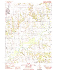
1983 Map of Roodhouse East
USGS Topo · Published 1984About this map
Roodhouse and the small settlement of Wrights anchor this early 1980s landscape, where the agriculture of central Illinois meets the industrial imprint of Strip Mines. The Illinois Central Gulf railroad cuts through the northwestern corner, serving as a primary corridor for the region's transport and trade. The area is defined by a complex drainage network, where Apple Creek and its many tributaries, including Lick Creek and Birch Creek, carve through the terrain. This map is particularly valuable for genealogical research, as it documents numerous family and community burial grounds such as Tumison Cem, Martins Prairie Cem, and Sanders Cem, many of which are associated with local congregations like Martins Prairie Ch and Friendship Ch. The presence of several Strip Mines north of Apple Creek suggests a period of transition in land use, while established public spaces like Community Park and American Legion Park reflect the civic life of the era.
Find a feature on this map
29 named features on this map. Tap any name to fly to it.
Don’t see what you’re looking for? This feature index may not catch every label — zoom into the map to look around manually.
Map Details
Editions of this 1983 Roodhouse East Map
This is the sole edition of this map. No revisions or reprints were ever made.
Other maps of this area

1924 · Winchester
USGS Topo · 1:48,000

1924 · Roodhouse
USGS Topo · 1:62,500

1926 · Winchester
USGS Topo · 1:62,500

1926 · Roodhouse
USGS Topo · 1:62,500

1932 · Greenfield
USGS Topo · 1:62,500

1932 · Jacksonville
USGS Topo · 1:62,500

1937 · Jacksonville
USGS Topo · 1:62,500

1948 · Quincy
USGS Topo · 1:250,000

1956 · Quincy
USGS Topo · 1:250,000
1983 · Alsey
USGS Topo · 1:24,000