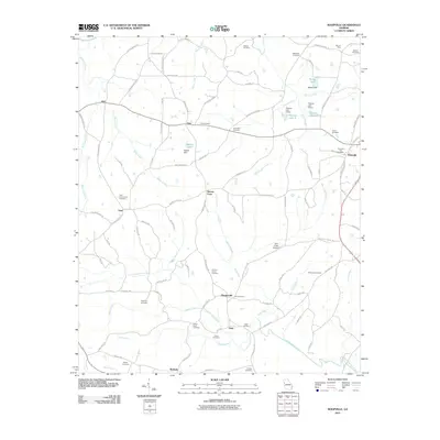
2011 Map of Roopville
USGS Topo · Published 2011About this map
Roopville stands as a primary hub in this Georgia landscape, situated at the intersection of Old Franklin Rd and Old Carrollton Rd. The surrounding countryside is defined by a dense network of local cemeteries and small rural crossroads settlements, including Tyus, Veal, and Roosterville. This distribution of family and community burial grounds, such as the Veal Community Cemetery and Lummie Layton Cemetery, suggests a long-settled agrarian history where neighborhood identity remained tied to these local landmarks. Industrial and transportation signatures appear in the northern reaches at the Bonner Mine and the more modern Gum Creek Airport near Stoney Point. The drainage patterns of Centralhatchee Creek and its many tributaries like Lizzies Branch and Denny Creek dictate the winding path of roads like Old Columbus Rd, illustrating how the waterway network shaped early land division and transit corridors in this portion of the state.
Find a feature on this map
100 named features on this map. Tap any name to fly to it.
Don’t see what you’re looking for? This feature index may not catch every label — zoom into the map to look around manually.
Map Details
Editions of this 2011 Roopville Map
This is the sole edition of this map. No revisions or reprints were ever made.
Other maps of this area

1889 · Tallapoosa
USGS Topo · 1:125,000

1892 · Tallapoosa
USGS Topo · 1:125,000

1897 · Tallapoosa
USGS Topo · 1:125,000

1899 · Wedowee
USGS Topo · 1:125,000

1902 · Wedowee
USGS Topo · 1:125,000

1953 · Atlanta
USGS Topo · 1:250,000

1957 · Atlanta
USGS Topo · 1:250,000

1958 · Atlanta
USGS Topo · 1:250,000

1958 · Carrollton
USGS Topo · 1:62,500

1964 · Roopville
USGS Topo · 1:24,000