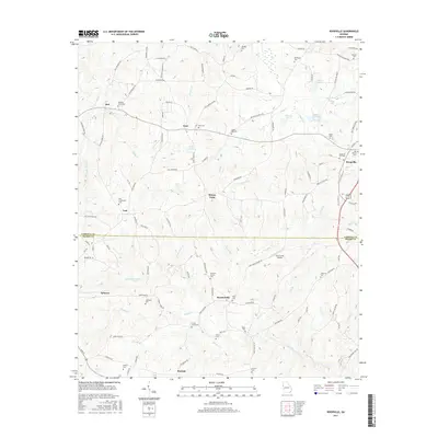
2017 Map of Roopville
USGS Topo · Published 2017About this map
Roopville sits on the eastern edge of this landscape, serving as a hub for the agricultural and residential districts that span the border between Carroll and Heard counties. The terrain is defined by a dense network of waterways including Centralhatchee Cr and Gum Creek, which wind through a patchwork of small communities like Tyus, Ephesus, and Roosterville. This modern survey reveals a countryside where family legacy remains prominent through numerous established burying grounds, such as Lummie Layton Cem, Crews Cem, and the Veal Community Cem near the settlement of Veal.
Find a feature on this map
119 named features on this map. Tap any name to fly to it.
Don’t see what you’re looking for? This feature index may not catch every label — zoom into the map to look around manually.
Map Details
Editions of this 2017 Roopville Map
This is the sole edition of this map. No revisions or reprints were ever made.
Other maps of this area

1889 · Tallapoosa
USGS Topo · 1:125,000

1892 · Tallapoosa
USGS Topo · 1:125,000

1897 · Tallapoosa
USGS Topo · 1:125,000

1899 · Wedowee
USGS Topo · 1:125,000

1902 · Wedowee
USGS Topo · 1:125,000

1953 · Atlanta
USGS Topo · 1:250,000

1957 · Atlanta
USGS Topo · 1:250,000

1958 · Atlanta
USGS Topo · 1:250,000

1958 · Carrollton
USGS Topo · 1:62,500

1964 · Roopville
USGS Topo · 1:24,000