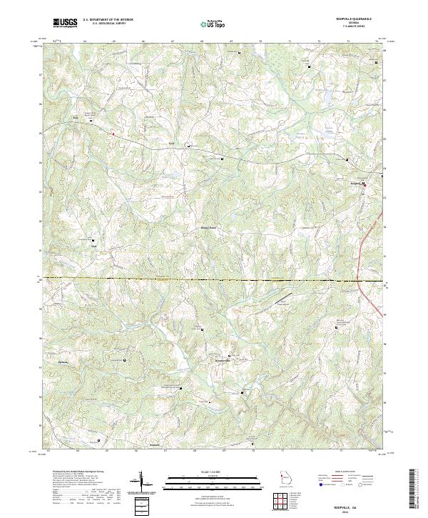
2024 Map of Roopville
USGS Topo · Published 2024About this map
Roopville sits at the eastern edge of this landscape where the undulating terrain of West Georgia transitions across the Carroll County and Heard County line. The map reveals a dense network of rural life, anchored by numerous country churches and family burial grounds such as Pleasant Grove Baptist Church Cem and Crews Cem. This area is defined by its watercourses, with Centralhatchee Creek and Gum Creek carving through the hills, creating a patchwork of small communities like Tyus, Roosterville, and Ephesus.
Find a feature on this map
123 named features on this map. Tap any name to fly to it.
Don’t see what you’re looking for? This feature index may not catch every label — zoom into the map to look around manually.
Map Details
Editions of this 2024 Roopville Map
This is the sole edition of this map. No revisions or reprints were ever made.
Other maps of this area

1889 · Tallapoosa
USGS Topo · 1:125,000

1892 · Tallapoosa
USGS Topo · 1:125,000

1897 · Tallapoosa
USGS Topo · 1:125,000

1899 · Wedowee
USGS Topo · 1:125,000

1902 · Wedowee
USGS Topo · 1:125,000

1953 · Atlanta
USGS Topo · 1:250,000

1957 · Atlanta
USGS Topo · 1:250,000

1958 · Atlanta
USGS Topo · 1:250,000

1958 · Carrollton
USGS Topo · 1:62,500

1964 · Roopville
USGS Topo · 1:24,000