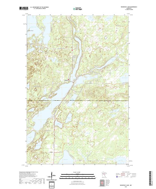
2022 Map of Roosevelt Lake
USGS Topo · Published 2022About this map
Roosevelt Lake dominates the center of this modern Minnesota landscape, serving as a primary focal point for the settlements of Outing and Emily. The map details a complex system of interconnected waterways and glacial lakes, including Washburn Lake, Lawrence Lake, and Ruth Lake. This area, straddling the boundary between Cass Co and Crow Wing Co, exhibits a dense network of local access roads such as Teddy Bear Acres Rd NE and Bloodroot Ln NE that weave between the shorelines.
Find a feature on this map
74 named features on this map. Tap any name to fly to it.
Don’t see what you’re looking for? This feature index may not catch every label — zoom into the map to look around manually.
Map Details
Editions of this 2022 Roosevelt Lake Map
This is the sole edition of this map. No revisions or reprints were ever made.
Other maps of this area

1913 · Cuyuna
USGS Topo · 1:62,500

1915 · Cuyuna
USGS Topo · 1:62,500

1953 · Duluth
USGS Topo · 1:250,000

1953 · Brainerd
USGS Topo · 1:250,000

1957 · Brainerd
USGS Topo · 1:250,000

1958 · Brainerd
USGS Topo · 1:250,000

1958 · Duluth
USGS Topo · 1:250,000

1960 · Cross Lake
USGS Topo · 1:24,000

1965 · Brainerd
USGS Topo · 1:250,000

1970 · Laura Lake
USGS Topo · 1:24,000