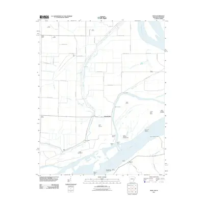
2011 Map of Rosa
USGS Topo · Published 2011About this map
The Mississippi River dominates this 2011 survey, defining a landscape shaped by shifting waters and the commerce of river landings. Small rural settlements like Rosa and Ashport anchor the riverbank, while family legacy is preserved at Hatchie Cemetery, Mann Cemetery, and Steger Cemetery. The intricate hydrology of the floodplains is visible through the winding course of Mill Bayou, Bear Bayou, and Long Lake, showing how water management and natural drainage dictate the layout of agricultural tracts such as Clear Lake Farm.
Find a feature on this map
64 named features on this map. Tap any name to fly to it.
Don’t see what you’re looking for? This feature index may not catch every label — zoom into the map to look around manually.
Map Details
Editions of this 2011 Rosa Map
This is the sole edition of this map. No revisions or reprints were ever made.
Other maps of this area

1939 · Hales Point
USGS Topo · 1:62,500

1939 · Blytheville
USGS Topo · 1:62,500

1952 · Hales Point
USGS Topo · 1:62,500

1955 · Blytheville
USGS Topo · 1:62,500

1956 · Blytheville
USGS Topo · 1:250,000

1959 · Blytheville
USGS Topo · 1:250,000

1961 · Hales Point
USGS Topo · 1:62,500

1961 · Rialto
USGS Topo · 1:62,500

1962 · Rialto
USGS Topo · 1:62,500

1962 · Hales Point
USGS Topo · 1:62,500