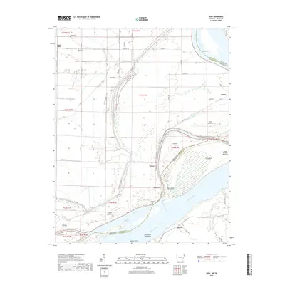
2020 Map of Rosa
USGS Topo · Published 2020About this map
The Mississippi River dominates this 2020 borderland, where the shifting currents of the Canadian Reach and Ashport Bend define the boundary between Tennessee and Arkansas. The landscape is a complex network of active and relic river features, including Fletcher Towhead, Kate Aubrey Towhead Bar, and numerous numbered islands such as Island Number 25 and Island Number Twentyseven. These landforms, along with Stiegers Eddy and Barfield Bend, illustrate the dynamic nature of the river's path over time.
Find a feature on this map
60 named features on this map. Tap any name to fly to it.
Don’t see what you’re looking for? This feature index may not catch every label — zoom into the map to look around manually.
Map Details
Editions of this 2020 Rosa Map
This is the sole edition of this map. No revisions or reprints were ever made.
Other maps of this area

1939 · Hales Point
USGS Topo · 1:62,500

1939 · Blytheville
USGS Topo · 1:62,500

1952 · Hales Point
USGS Topo · 1:62,500

1955 · Blytheville
USGS Topo · 1:62,500

1956 · Blytheville
USGS Topo · 1:250,000

1959 · Blytheville
USGS Topo · 1:250,000

1961 · Hales Point
USGS Topo · 1:62,500

1961 · Rialto
USGS Topo · 1:62,500

1962 · Rialto
USGS Topo · 1:62,500

1962 · Hales Point
USGS Topo · 1:62,500