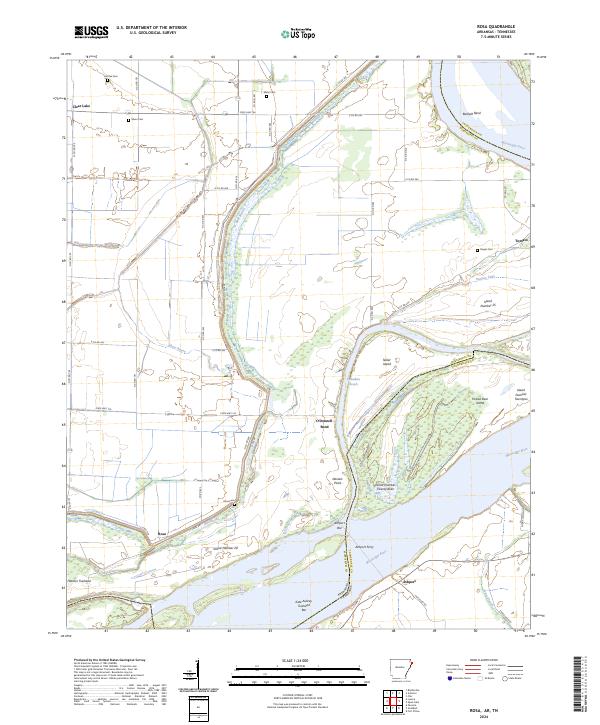
2024 Map of Rosa
USGS Topo · Published 2024About this map
The Mississippi River defines this landscape along the border of Arkansas and Tennessee, where the channel has historically shifted to create a complex network of chutes and islands. Early river navigation and settlement patterns are evident in labels like Ashport Ferry and Canadian Reach. On the Arkansas side, small agricultural communities such as Tomato and Rosa sit behind a network of levees and bayous, including Mill Bayou and Bear Bayou. Family and community history is preserved in several small burial grounds like Mann Cem, Steger Cem, and Hatchie Cem, which anchor the rural landscape. The map highlights the dynamic nature of the river corridor, featuring prominent landforms like Barfield Bend and O'Donnell Bend, alongside numerous islands such as Island Number 25 and Forked Deer Island.
Find a feature on this map
59 named features on this map. Tap any name to fly to it.
Don’t see what you’re looking for? This feature index may not catch every label — zoom into the map to look around manually.
Map Details
Editions of this 2024 Rosa Map
This is the sole edition of this map. No revisions or reprints were ever made.
Other maps of this area

1939 · Hales Point
USGS Topo · 1:62,500

1939 · Blytheville
USGS Topo · 1:62,500

1952 · Hales Point
USGS Topo · 1:62,500

1955 · Blytheville
USGS Topo · 1:62,500

1956 · Blytheville
USGS Topo · 1:250,000

1959 · Blytheville
USGS Topo · 1:250,000

1961 · Hales Point
USGS Topo · 1:62,500

1961 · Rialto
USGS Topo · 1:62,500

1962 · Rialto
USGS Topo · 1:62,500

1962 · Hales Point
USGS Topo · 1:62,500