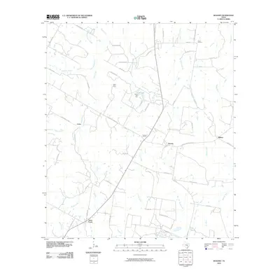
2010 Map of Rosanky
USGS Topo · Published 2010About this map
Rosanky and the surrounding Bastrop County countryside are defined by a network of creeks and small family-named settlements in this 2010 study. The landscape is dominated by the drainage systems of Sandy Creek, Piney Creek, and Brushy Creek, which carve through the terrain south of Roundup Ridge. Local history is anchored by sites such as the Rosanky Cemetery and Young Cemetery, while the road names provide a window into the area's social geography, specifically Young School House Rd. To the north, Foster Lake Dam regulates Foster Lake, marking one of the few significant water engineering projects in this rural corridor. Small communities like String Prairie, Willman, and Jordan appear as quiet junctions along the local farm-to-market roads, maintaining the traditional character of the Texas post-oak savannah before modern suburban expansion.
Find a feature on this map
58 named features on this map. Tap any name to fly to it.
Don’t see what you’re looking for? This feature index may not catch every label — zoom into the map to look around manually.
Map Details
Editions of this 2010 Rosanky Map
This is the sole edition of this map. No revisions or reprints were ever made.
Other maps of this area

1885 · Bastrop
USGS Topo · 1:125,000

1893 · Bastrop
USGS Topo · 1:125,000

1901 · Flatonia
USGS Topo · 1:125,000

1904 · Bastrop
USGS Topo · 1:125,000

1948 · Smithville
USGS Topo · 1:62,500

1948 · Bastrop
USGS Topo · 1:62,500

1950 · Bastrop
USGS Topo · 1:62,500

1950 · Smithville
USGS Topo · 1:62,500

1953 · Seguin
USGS Topo · 1:250,000

1954 · Austin
USGS Topo · 1:250,000