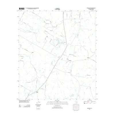
2013 Map of Rosanky
USGS Topo · Published 2013About this map
Rosanky serves as the central hub of this Bastrop County landscape, where the convergence of rural routes and local landmarks defines a community rooted in the sandy loam of Central Texas. The map highlights a network of watercourses including Sandy Cr and Piney Cr, which drain the undulating terrain toward Foster Lake. To the north, the elevation rises toward High Point and the prominent Roundup Rdg, while local history is anchored by the Rosanky Cem and Young Cem. This 2013 survey illustrates the modern layout of smaller communities like String Prairie and Willman, showing how property lines and secondary roads like La Reata Trl and Pony Express Dr have evolved around established family-named sites. The presence of Jordan and the various creeks suggests a landscape where the natural drainage patterns continue to influence the placement of rural residences and agriculture.
Find a feature on this map
68 named features on this map. Tap any name to fly to it.
Don’t see what you’re looking for? This feature index may not catch every label — zoom into the map to look around manually.
Map Details
Editions of this 2013 Rosanky Map
This is the sole edition of this map. No revisions or reprints were ever made.
Other maps of this area

1885 · Bastrop
USGS Topo · 1:125,000

1893 · Bastrop
USGS Topo · 1:125,000

1901 · Flatonia
USGS Topo · 1:125,000

1904 · Bastrop
USGS Topo · 1:125,000

1948 · Smithville
USGS Topo · 1:62,500

1948 · Bastrop
USGS Topo · 1:62,500

1950 · Bastrop
USGS Topo · 1:62,500

1950 · Smithville
USGS Topo · 1:62,500

1953 · Seguin
USGS Topo · 1:250,000

1954 · Austin
USGS Topo · 1:250,000