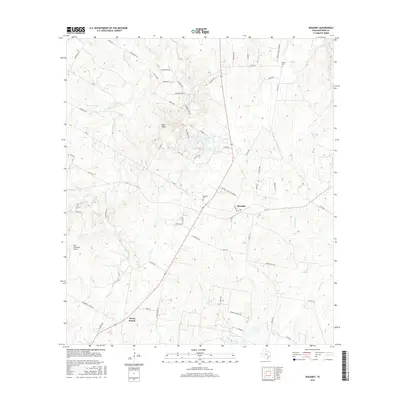
2016 Map of Rosanky
USGS Topo · Published 2016About this map
Rosanky serves as the central hub for this portion of Bastrop County, characterized by a transition from the rolling terrain of Roundup Ridge in the north to the more level drainage basins of the south. The settlement of String Prairie appears in the southwestern corner, reflecting the area's agricultural and rural heritage. This landscape is defined by its complex network of watercourses, including Sandy Creek and the long reach of Piney Creek, which fed local needs and shaped early travel routes. Genealogists will find the Rosanky Cemetery and Young Cemetery as vital anchors for tracing local family histories. The presence of High Lonesome Airport and various named landmarks like High Point demonstrate how this rural expanse has been navigated and identified by residents over generations.
Find a feature on this map
71 named features on this map. Tap any name to fly to it.
Don’t see what you’re looking for? This feature index may not catch every label — zoom into the map to look around manually.
Map Details
Editions of this 2016 Rosanky Map
This is the sole edition of this map. No revisions or reprints were ever made.
Other maps of this area

1885 · Bastrop
USGS Topo · 1:125,000

1893 · Bastrop
USGS Topo · 1:125,000

1901 · Flatonia
USGS Topo · 1:125,000

1904 · Bastrop
USGS Topo · 1:125,000

1948 · Smithville
USGS Topo · 1:62,500

1948 · Bastrop
USGS Topo · 1:62,500

1950 · Bastrop
USGS Topo · 1:62,500

1950 · Smithville
USGS Topo · 1:62,500

1953 · Seguin
USGS Topo · 1:250,000

1954 · Austin
USGS Topo · 1:250,000